Applications
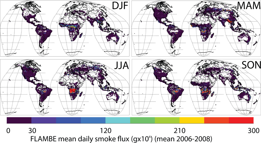
 The WFABBA user community has greatly expanded over the years. Numerous peer-reviewed publications show that user applications include hazards monitoring, climate change research, land-use/land-cover change studies, resource management, biomass burning emissions modeling, diagnostic and prognostic aerosol and trace gas modeling, and policy and decision making (Nepstad et al., 2001; 2006; Cardosa et al., 2003; Schmidt and Prins, 2003; McNamara et al., 2004; Freitas et al., 2007; Wang et al., 2006; Weaver et al., 2004). The image to the right, from Reid et al., 2009, shows global smoke emissions created from a model that in part uses WFABBA fire locations and characteristics.
Within the United States biomass burning is a source of aerosols and precursors to ozone formation that must be monitored as mandated by the Clean Air Act with specific PM 2.5 (particulate matter that is 2.5 µm or smaller in size) regulations defined under the 1997 amendment. Biomass burning from both wildfires and agricultural burning remains one of the largest unknowns in source emissions in the U.S. Applications of the WFABBA in model data assimilation studies have shown the importance of incorporating real-time diurnal fire products (both fire location and sub-pixel characteristics) in aerosol transport and air quality models to correctly diagnose and predict air pollution (Reid et al., 2004; Al Saadi et al., 2005; Freitas et al., 2007; Wang, et al., 2006).
Visit the publications page and external links for more information on some projects that utilize WFABBA data.
Algorithm Description : History : Applications : Ongoing Work : People


